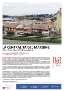
LA CENTRALITÀ DEL MARGINE. IL TERRITORIO DOPO L’INFRASTRUTTURA
Living Lab di Roma-San Cesareo, 18 -19 February 2025
The third SEW Line Living Lab provided a clear opportunity for the active and direct engagement of multiple actors—citizens, public institutions, companies, research bodies, and other stakeholders—in processes of co-creation, experimentation, and validation of solutions to address complex challenges in real-world contexts.
In this sense, the territorial context of San Cesareo was used as a starting point to develop broader reflections on the ecological-environmental, social, and landscape dynamics triggered at the local scale by the introduction of major infrastructure. San Cesareo lies at the southern end of the A1 motorway spur, an approximately 50 km section designed as a single project and inaugurated in 1988. The urban and peri-urban landscapes crossed and transformed by the infrastructure, the time elapsed since its completion, and its long operational phase offer a unique opportunity for an ex post analysis of large-scale landscape and territorial transformations—making San Cesareo a case of outstanding interest for the research.
Day 1 — Research Lab 3
The consolidated infrastructure: outcome landscapes and trajectories of change
The opportunity to analyse ex post the recurring effects that major infrastructures generate on landscape and territory led to the selection of San Cesareo as the case study for the third Research Lab. In collaboration with the local administration, and following a series of field surveys organised by territorial units and supported by territorial studies, three “outcome infrastructure landscapes” linked to the motorway spur were identified:
a. Along the edge.
The built-up area of San Cesareo is encircled by the spur, which cuts across the municipal territory by following—or overpassing—the complex ground morphology. Traversing the route made it possible to observe the heterogeneity of urban edges produced over time, offering insights to reflect on potential new spatial and functional configurations.
b. The public city.
After the opening of the motorway tollgate, San Cesareo became an autonomous municipality, yet it lacks a historical centre as a reference. In recent decades, a civic hub concentrating public functions and collective services has been developed. Today, this area is separated from the rest of the territory and is at the core of an expansion project aimed at households employed in the productive sector—opening a discussion on the municipality’s spatial, social, and functional relationships.
c. The “small Brianza”.
In the absence of an adequate urban plan, local entrepreneurs reshaped the area’s productive vocation, giving rise to one of Lazio’s most dynamic industrial consortia. The productive area—also characterised by spaces of unexpected quality—is entering a new phase of expansion, suggesting the need to envision productive models that are more integrated from a functional, ecological, and landscape perspective.
Day 2 — San Cesareo Workshop
Historicised infrastructure: outcome landscapes and evolutionary scenarios
The San Cesareo workshop adopted a structure alternating collective sessions and parallel thematic tables, offering an opportunity to observe the long-term effects of an infrastructure that has become historically embedded, as well as the transformation trajectories it continues to generate.
The introductory session (speaker: Andrea Gritti) proposed a cultural and historical reading of the transformations associated with the Autostrada del Sole, recalling the idea of infrastructure as a “permanent disturbance” capable of deeply shaping both imaginaries and territorial organisation.
Working Table 1 — “Metropolisation processes and the growth of productive areas”
This table focused on the large productive zones that have developed near motorway interchanges, highlighting how—when a structured public strategy is missing—economic actors often redefine the vocation of territories. The discussion stressed the need for more sustainable, nature-positive productive models, capable of returning environmental and social value to local communities, and the role of landscape design as a mediation tool between public and private interests.
Participants: Adriano Bianchi (Municipality of San Cesareo), Mauro Ginepri (San Cesareo Industrial Consortium), Mauro Baioni (Roma Tre University), Maria Lucia Sparagna (Metropolitan City of Rome), Francesco Sica (Sapienza University of Rome), Luca Catalano (OSA Open Space Architecture).
Coordination and introduction: Mario Paris.
Working Table 2 — “Infrastructure landscapes and natural capital”
This table addressed persistent ecological-environmental issues linked to the infrastructure, highlighting the limits of approaches restricted to mitigation alone. The discussion emphasised the need to make evolutionary scenarios mandatory within project protocols, in order to anticipate long-term effects and integrate environmental protection, safety, and quality of life. The concluding exchange confirmed the value of remedial practices and of landscape design as a knowledge-based and operational device to stitch together fragmentation and steer sustainable transformations over time.
Participants: Giuseppe De Pasquale (Municipality of San Cesareo), Lodovico Vannicelli Casoni (Metropolitan City of Rome), Giovanni Giacomello (University of Padua), Mauro Maesano (UniTuscia – DIBAF), Davide Marino (University of Molise), Cristina Imbroglini (Sapienza University of Rome).
Coordination and introduction: Catherine Dezio.
The final session presented a set of case studies on remedial practices in contexts marked by infrastructural marginality, reinforcing the role of landscape design as a device for reconnection and for guiding territorial transformations.
Participants: Lucina Caravaggi (Sapienza University of Rome), Federica Fava (Roma Tre University), Cristiana Mattioli and Chiara Nifosì (Politecnico di Milano), Rome Di Pietro (Sapienza University of Rome).
Coordination and introduction: Anna Lei.